Preliminary - Under Construction
|
This site is being developed for the purpose of documenting the route of
the road as well as evaluating various images. The eventual use of this site will be used for later articles in various media.
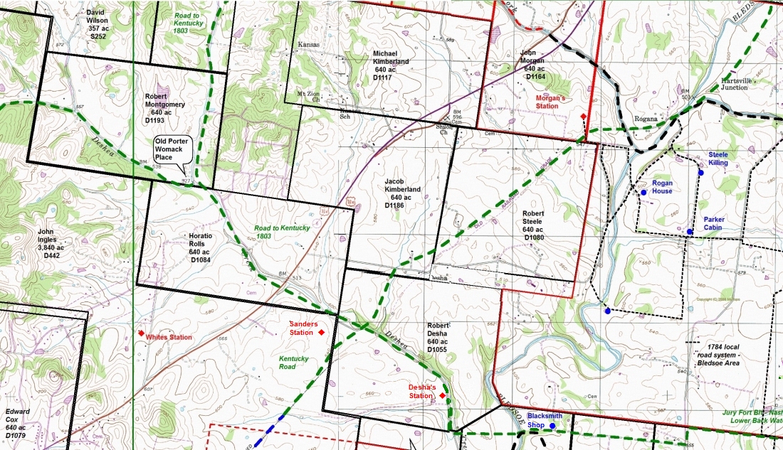
We chose to arbitrarily call the road the "Station Camp Backwater Road". The road crosses Dobbins Pike a little over 4 miles north of Gallatin and runs
approximately 8 miles SW until it intersects Red River Road at Liberty Lane which is a little
less than 4 miles from Gallatin.
Work came about as a result of a conversation between Terry Bartlett and Bill Puryear detailing what Terry called "an old Ox Road" which
he knew about on his property as well as other properties along the central eastern section of the road. My involvement came about as a result
of Bill's excitement after viewing several sections of the road. We have
discovered many similar roads over the years and after viewing there was no doubt as to the validity of the road.
Research is being conducted in an effort to learn the actual name for this road using original land grants as well as deed records. Property owners along
the path have been very cordial and encouraging as to further development. You are invited to
follow the progress of this project as we continue work in it's development.
Jack Masters, Bill Puryear & Terry Bartlett
|
Click on map for larger image
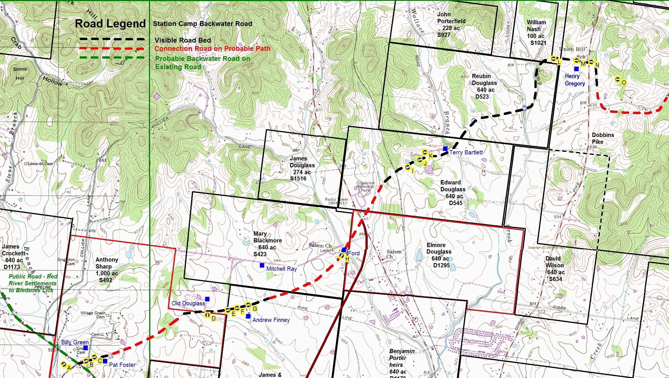
Click on letter in the chart below for desired image shown on the above Map Notice that the arrow, associated with the letter view, points the direction of the image
| Aerial view of end of the Road at Red River Road (Hwy 25) and Liberty Lane | |
| View East from Village Green Road near Pat Fosters Mailbox | |
| View East from Backwater Road Bed near the Fosters home | |
| View North from Backwater Road in front of the Old Douglass Place | |
| View East from Douglass Lane as Backwater Road follows Andrew Finney's Driveway | |
| View West from Backwater Road bed on the property of Mitchell Ray towards Finney Drive | |
| View East from Backwater Road bed on the property of Mitchell Ray as road continues towards the ford on Station Camp Creek. | |
| View North and East from where the Old Backwater Road crosses the ford on Station Camp Creek | |
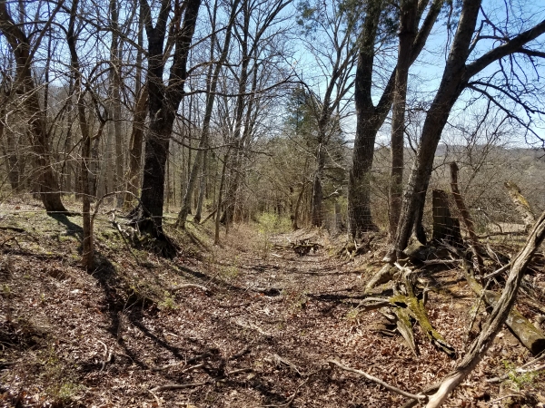
| View West in the old road bed on the Terry Bartlett Family Farm | |
| View West in the old road bed on the Terry Bartlett Family Farm | |
| View West in the old Wallace Cemetery | |
| View West on Henry Gregory Farm just prior to turning down hill | |
| View East on Henry Gregory Farm just West of Dobbins Pike | |
| View East immediately East of Dobbins Pike | |
| Aerial view in the area East of Dobbins Pike showing right turn South and after a short run the end of all signs of the Road |
Click on map for larger image