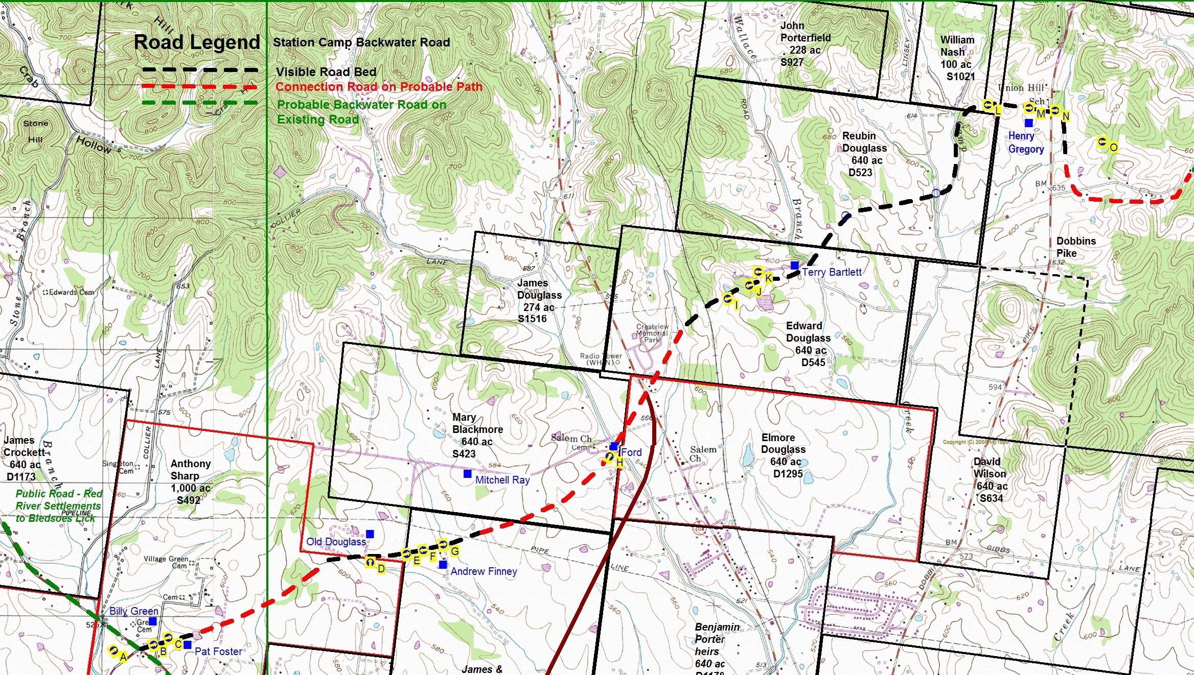
Click on letter in the chart below for desired image shown on the above Map
| Aerial view of end of the Road at Red River Road (Hwy 25) and Liberty Lane | |
| View East from Village Green Road near Pat Fosters Mailbox | |
| View East from Backwater Road Bed near the Fosters home | |
| View North from Backwater Road in front of the Old Douglass Place | |
| View East from Douglass Lane as Backwater Road follows Andrew Finney's Driveway | |
| View West from Backwater Road bed on the property of Mitchell Ray towards Finney Drive | |
| View East from Backwater Road bed on the property of Mitchell Ray as road continues towards the ford on Station Camp Creek. | |
| View North and East from where the Old Backwater Road crosses the ford on Station Camp Creek | |
| View West in the old road bed on the Terry Bartlett Family Farm | |
| View West in the old road bed on the Terry Bartlett Family Farm | |
| View West in the old Wallace Cemetery | |
| View West on Henry Gregory Farm just prior to turning down hill | |
| View East on Henry Gregory Farm just West of Dobbins Pike | |
| View East immediately East of Dobbins Pike | |
| Aerial view in the area East of Dobbins Pike showing right turn South and after a short run the end of all signs of the Road |